Announcement

Collapse
No announcement yet.

My Adventures Thread

Collapse
X
 
  • Filter
  • Time
  • Show
Clear All
new posts

  • #76
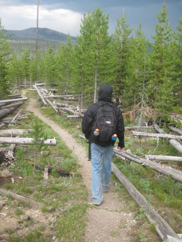
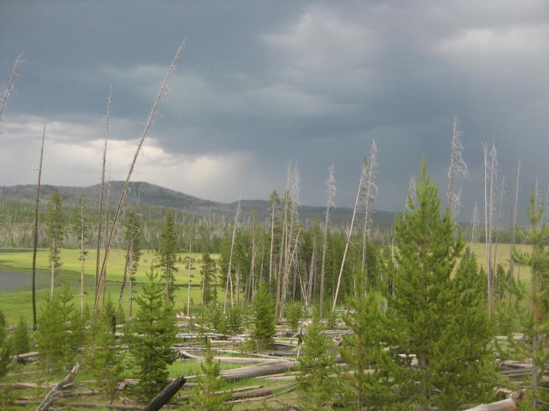
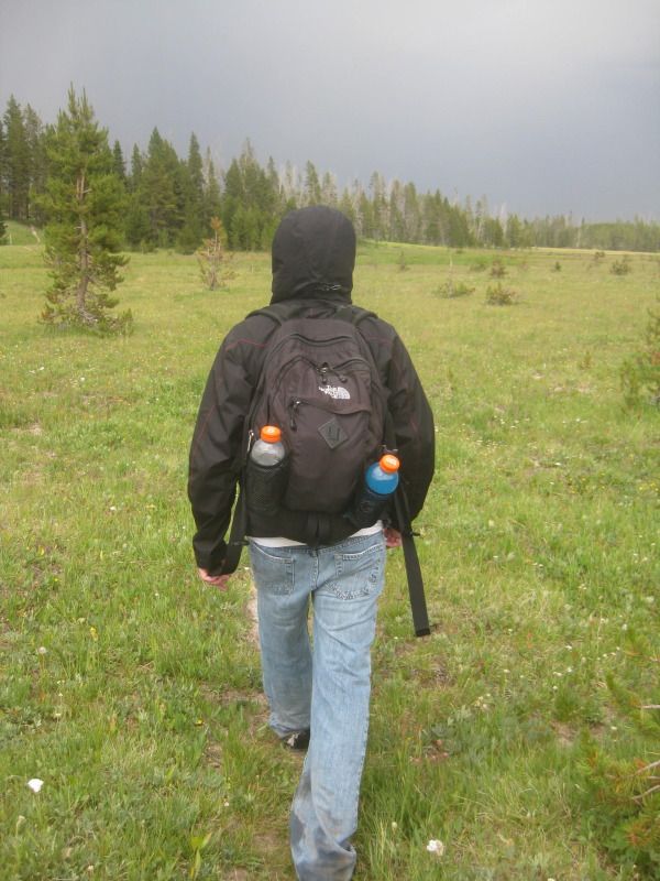
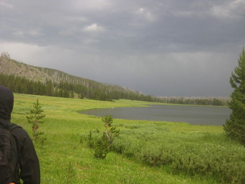
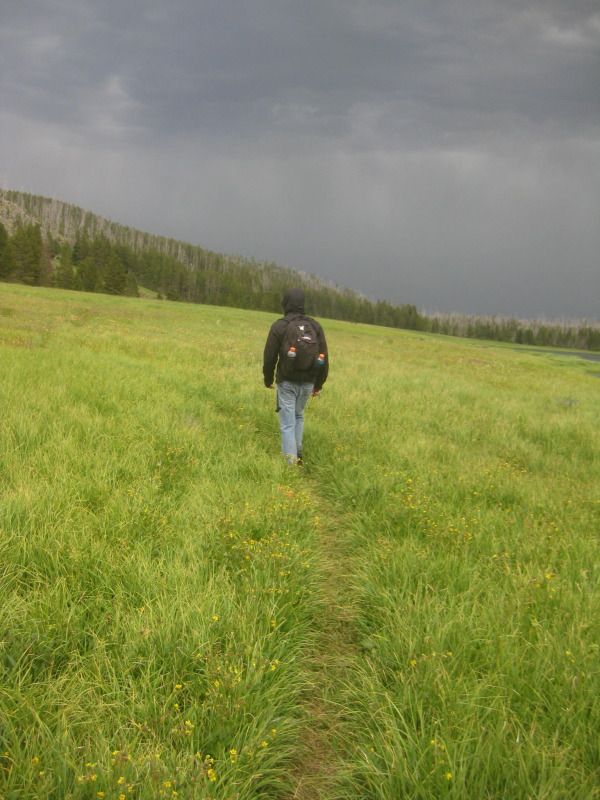
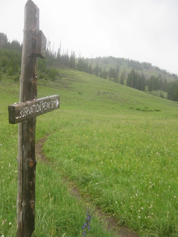
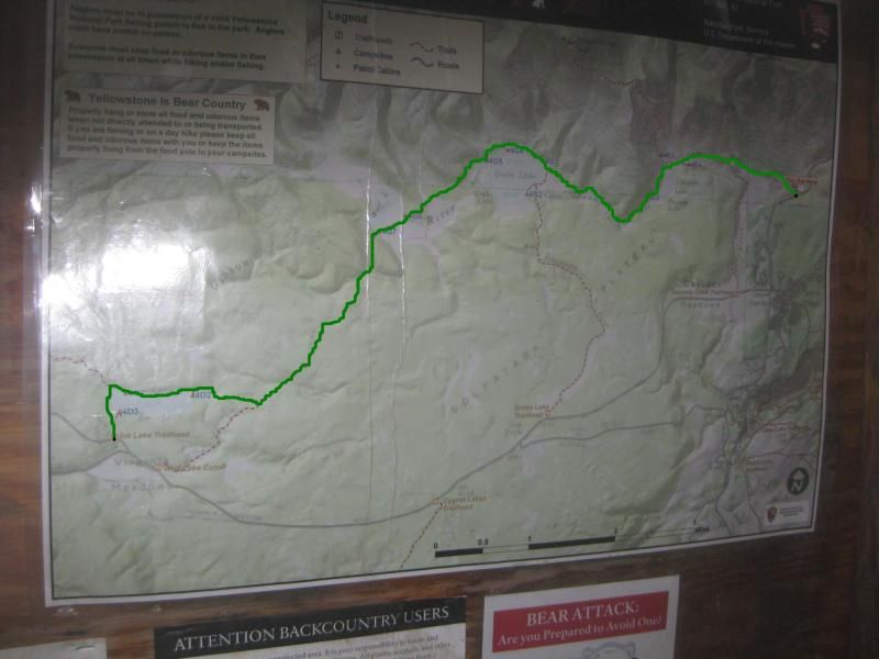
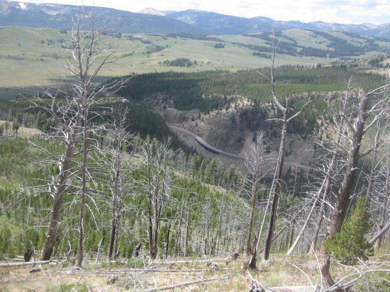
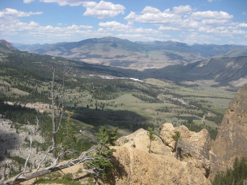
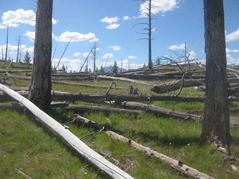
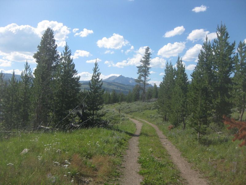
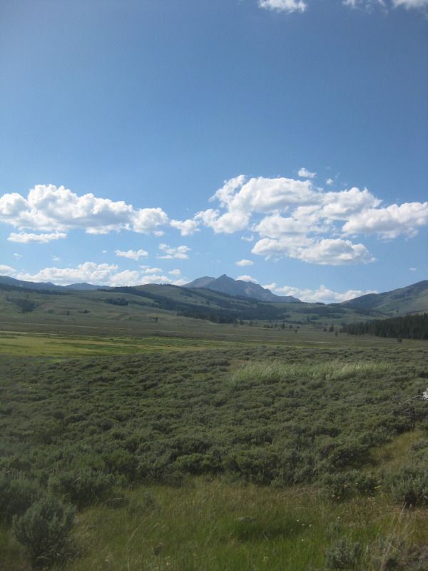
    After crossing the Gibbon River twice we were heading towards Wolf Lake. The sky started to look ominous.


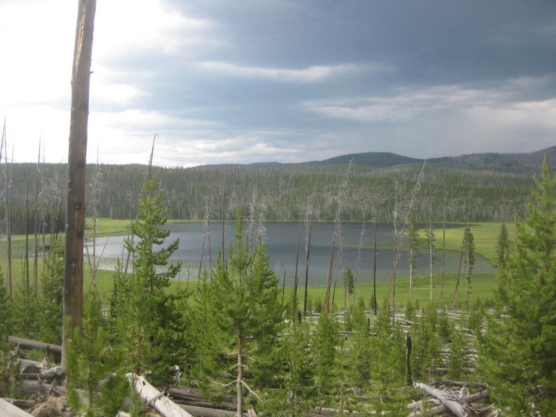
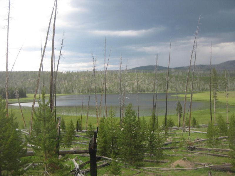
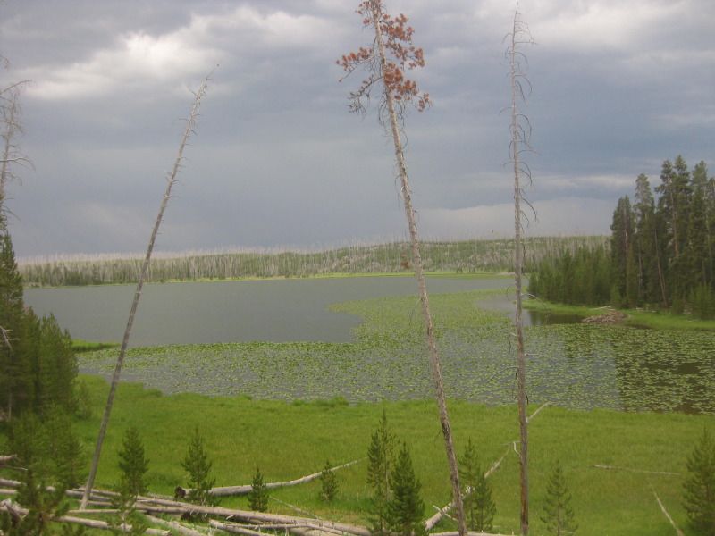
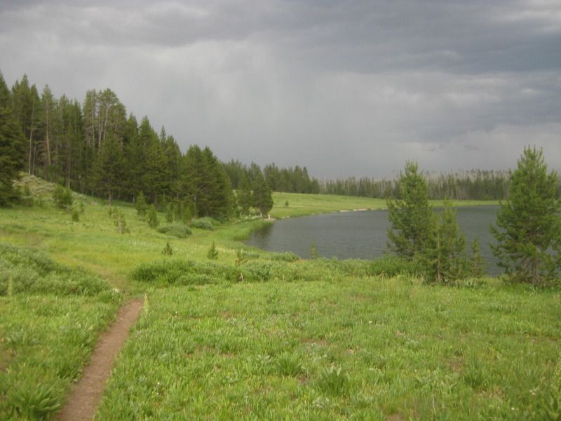
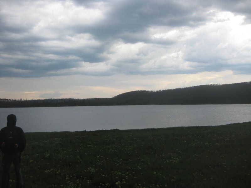
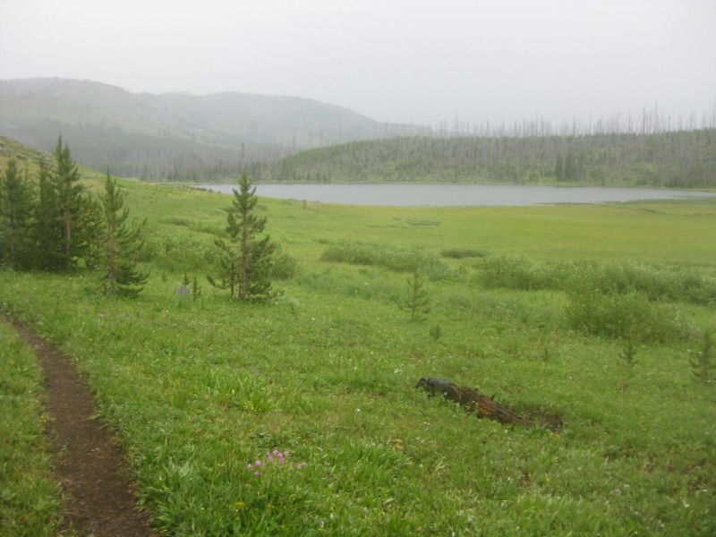
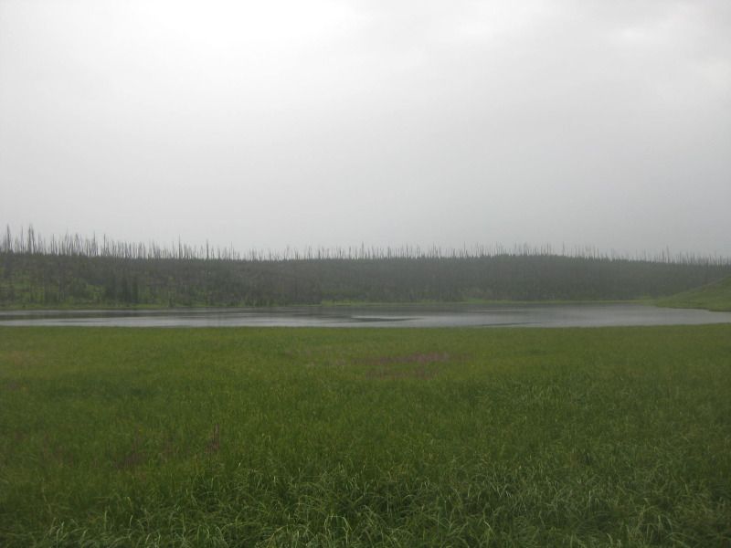
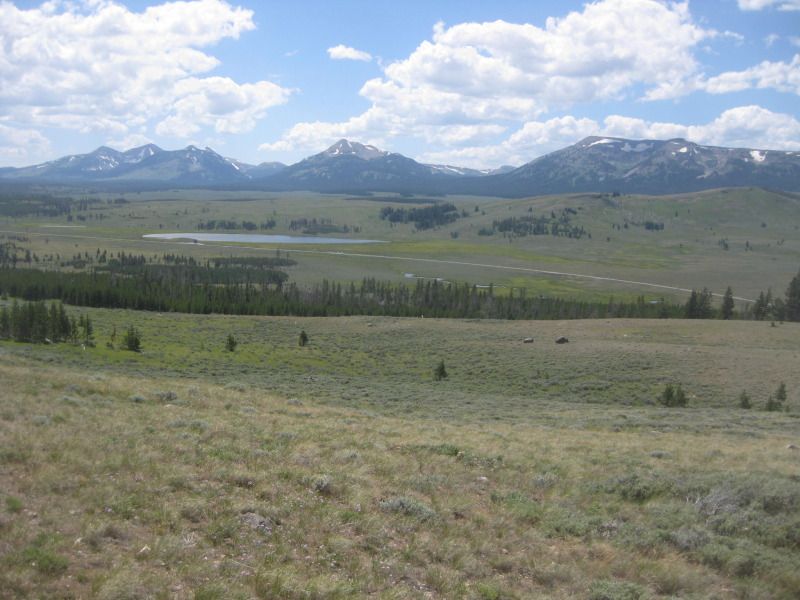
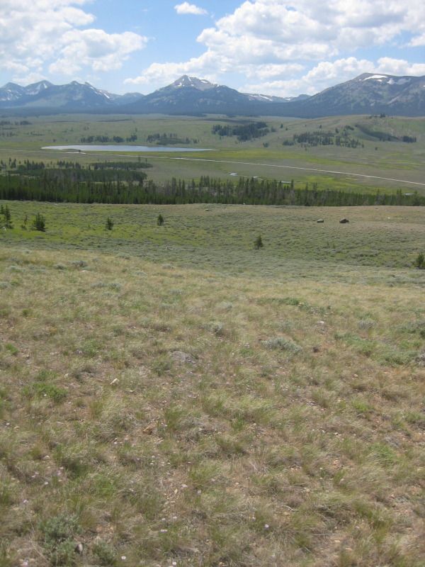
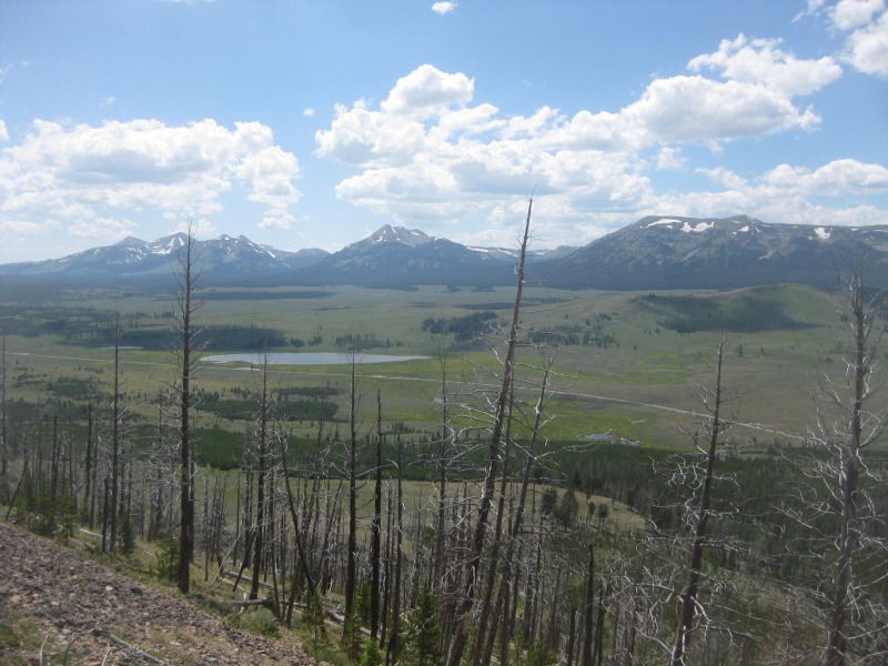
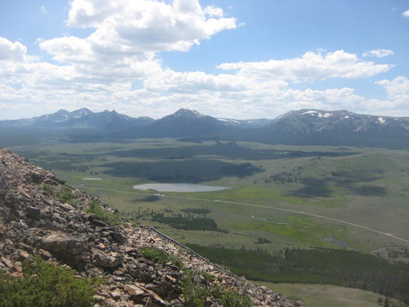
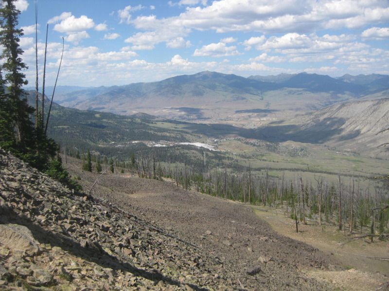
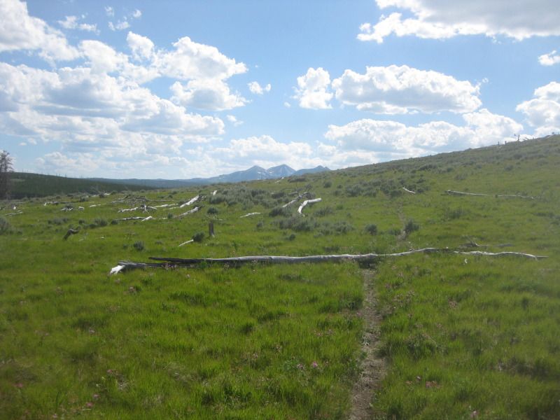
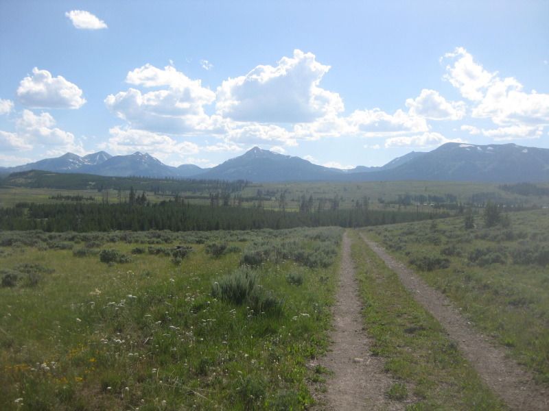
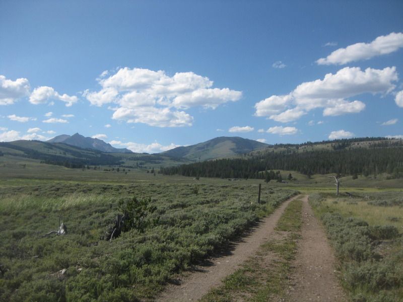
    First view of Wolf Lake and the meadow next to it.
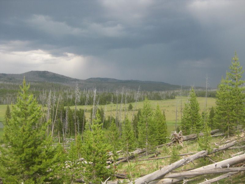
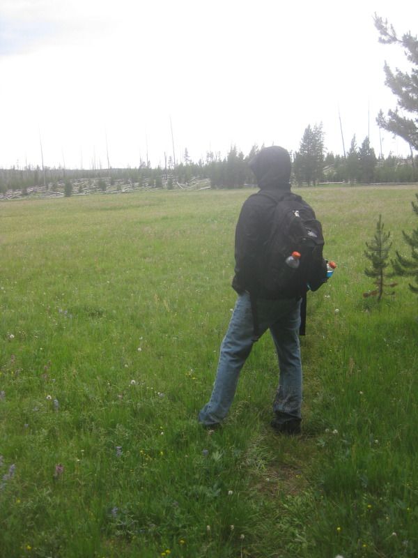
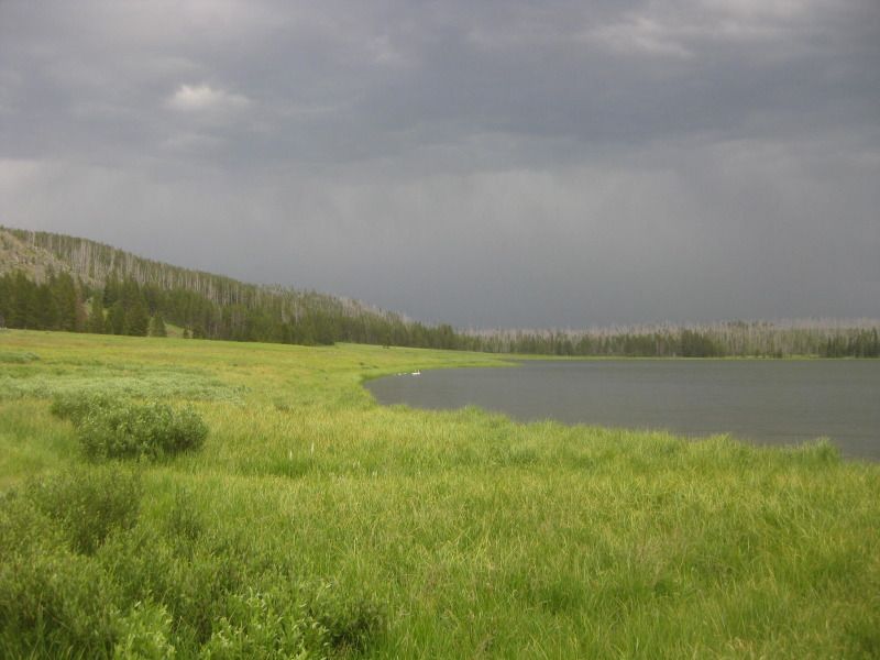
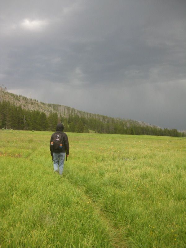
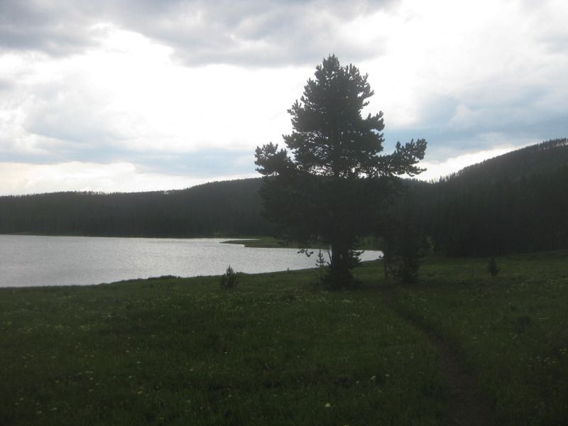
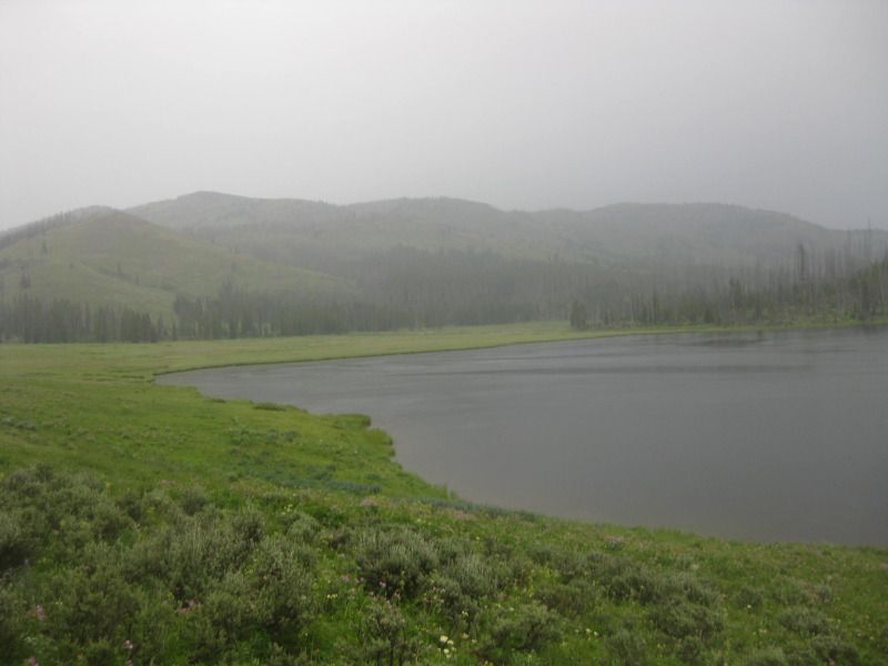
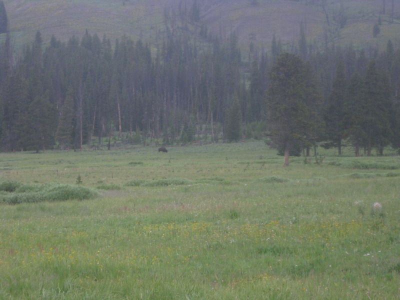
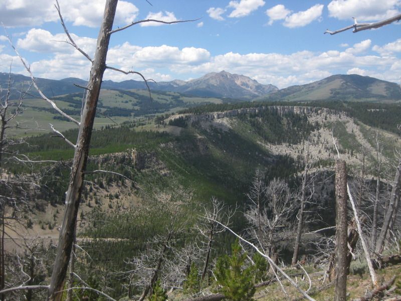
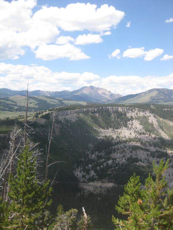
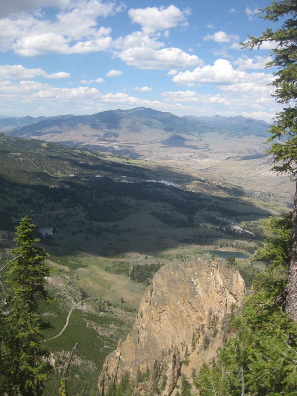
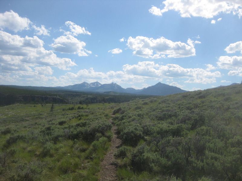
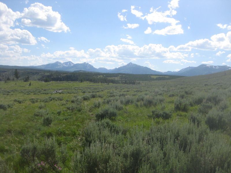
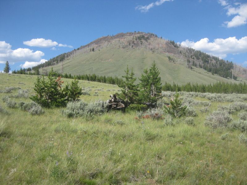
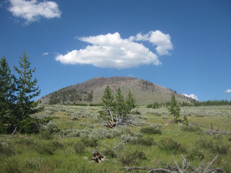


    Almost there.


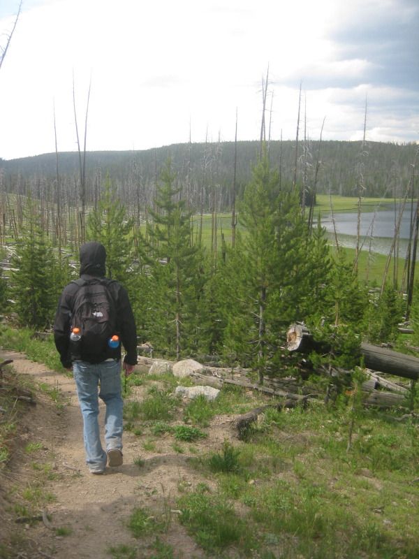
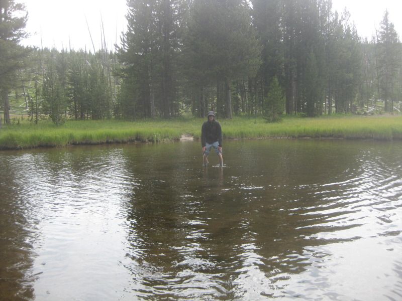
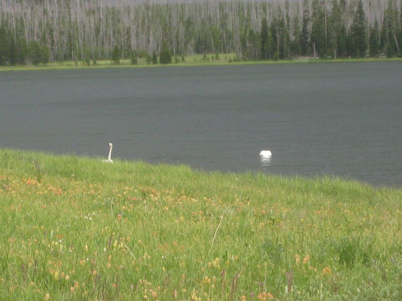
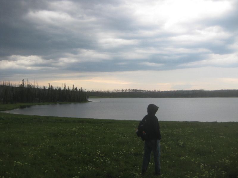
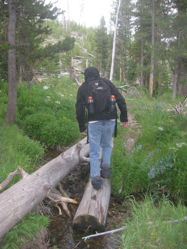
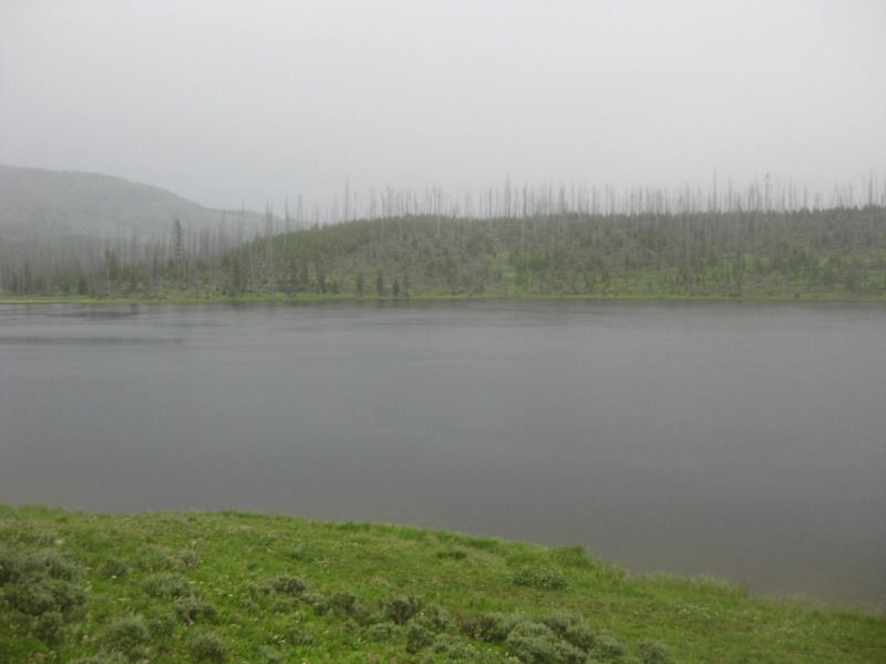
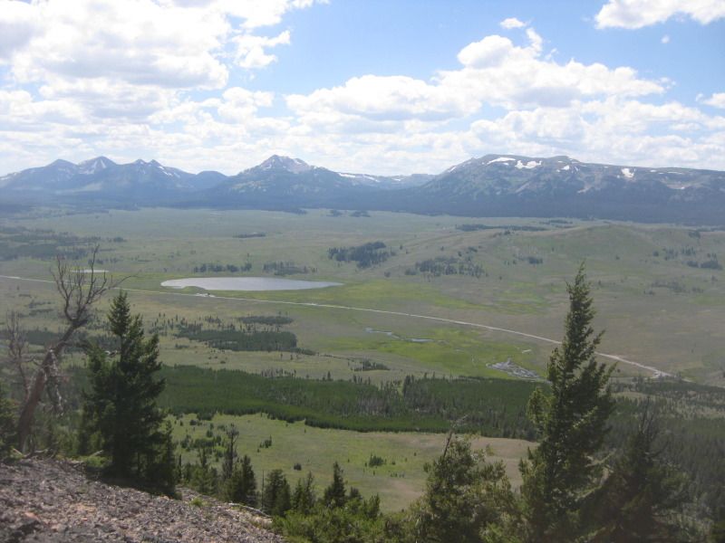
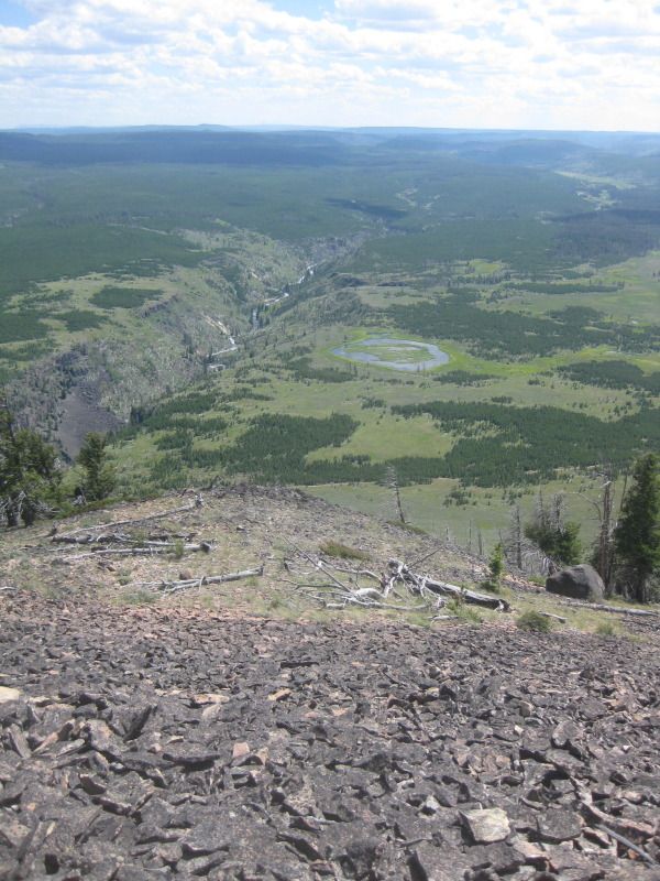
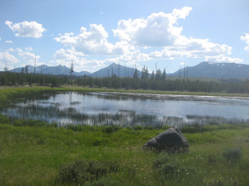
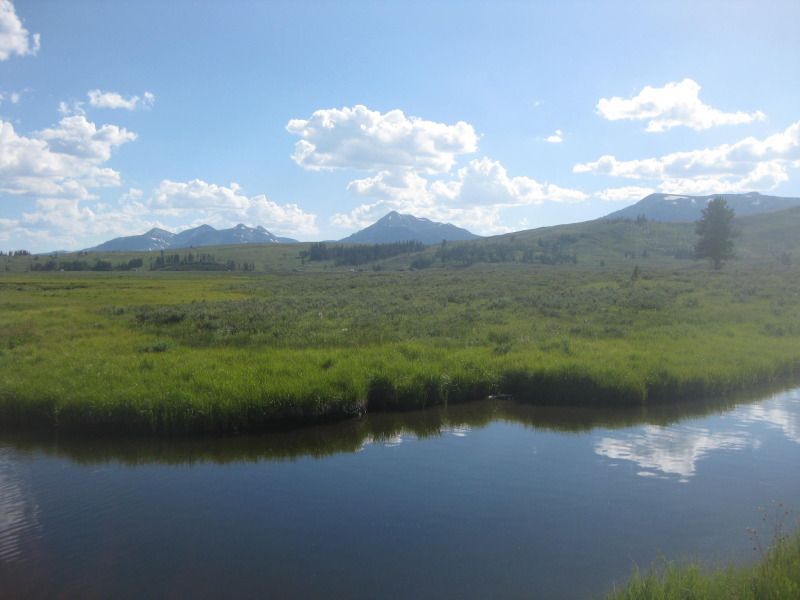
    Wolf Lake and the "waterway" attached to it.


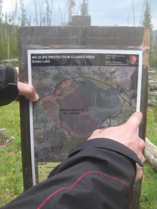
    Knew this was coming. Had read about it. Had a couple of coworkers that said it was thigh deep (they are 6' 4" and 6' 5"). Luckily it wasn't too deep 40 days later.

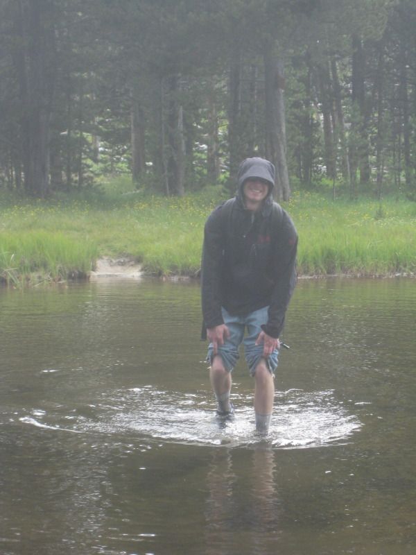
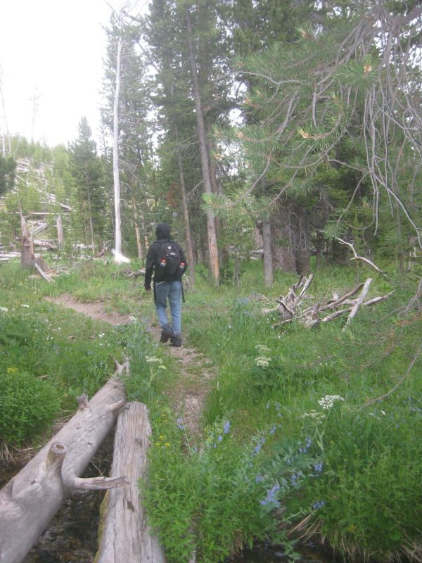
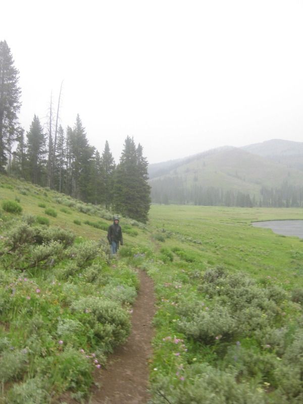
    After the Wolf Lake "waterway" crossing we hit the 4 mile mark of the hike! Only 6 1/2 miles to go.


    99 Dub Ya Jay

    My Adventures Thread
    http://sisoffroad.com/forums/showthread.php?t=15148

    Comment


    • #77
      Crossing the meadow near Wolf. We took a 15 or 20 minute break here to decide if we should turn back or not. There were lightning bolts crashing down all over the place.

      The weather went from 80* and sunny to 55* clouds, wind, lighting and thunder. We decided to push on for the last 6 1/2 miles.


      First view of Grebe Lake. 5 miles into the trail. 5 1/2 miles left to hike.


      Showing my gf where we are on the map and where we are heading.

      Not sure why there is an area "closed to all travel".


      Near a campsite on Grebe Lake. Food storage away from animals.


      The trail opening up along Grebe Lake. Some trumpeter swans visible.

      Last edited by BOX; 07-21-2012, 12:59 PM.
      99 Dub Ya Jay

      My Adventures Thread
      http://sisoffroad.com/forums/showthread.php?t=15148

      Comment


      • #78
        Trumpeter swans on Grebe.


        Jurrasic Park esq


        Grebe Lake, the trail and some fisherman in the background. 6 miles round trip for the fisherman from the Grebe Lake trailhead.


        More Grebe.


        99 Dub Ya Jay

        My Adventures Thread
        http://sisoffroad.com/forums/showthread.php?t=15148

        Comment


        • #79
          From the 5 1/2 mile mark at end of Grebe Lake to the 7 1/2 mile mark at the start of Cascade Lake the skies opened up. The trail also crossed what seemed like a dozen creeks and several marshes.

          Only snapped these 2 before it really started coming down.


          First view of Cascade Lake. 7 1/2 miles in the trail. 3 miles left to hike.


          Cascade Lake. Still raining some.


          The trail, me wet, and Cascade.


          Observation Peak trail intersection. 8 miles down and 2 1/2 miles left.


          One last look at Cascade Lake from the west side.

          99 Dub Ya Jay

          My Adventures Thread
          http://sisoffroad.com/forums/showthread.php?t=15148

          Comment


          • #80
            A bison in the meadow leaving the Cascade Lake area.


            9 1/2 miles hiked. 1 mile left to hike!

            Did not take many pictures at the end because of the weather.


            We started hiking from the Ice Lake trailhead (elevation 7,825) at 200pm and made it back to my girlfriend's Jeep at the Cascade Lake trailhead (elevation 8,025) at 700pm. Hiked by Ice Lake, Wolf Lake, Grebe Lake and Cascade Lake.

            It took us 5 hours to hike 10 1/2 miles in weather ranging from 80* and sunny to 50* and wind, rain, lightning and thunder.

            Side note kids. Wear a jacket or sunscreen when hiking at high elevations. My girlfriend got sunburn. If the skies hadn't clouded up..... she would have been in the hospital.

            99 Dub Ya Jay

            My Adventures Thread
            http://sisoffroad.com/forums/showthread.php?t=15148

            Comment


            • #81
              I left Canyon Village, WY around 200pm on July 18th with the goal of summiting Bunsen Peak.

              Bunsen Peak (elevation 8,527 feet) is named after the dude who invented the Bunsen burner, but he never actually stepped foot in Yellowstone. Ironically most of the trees around the peak burned during the fires of 1988.

              The Bunsen Peak trailhead (elevation 7,275) is around 28 miles northwest of Canyon Village where I live, but only around 5 miles south of Mammoth, WY (elevation 6,250). Left around 300pm.


              View of the peak from the trailhead.


              The peak is 2 1/10 miles from the trailhead.


              A 1/4 mile into the trail. View of Kingman Pass (elevation 7,119).


              From the same spot. View of Electric Peak (elevation 10,969).


              Electric Peak again a little further up. Electric Peak is the highest peak in the Gallatin Range and the 3rd highest peak in Yellowstone National Park.

              99 Dub Ya Jay

              My Adventures Thread
              http://sisoffroad.com/forums/showthread.php?t=15148

              Comment


              • #82
                A few 10,000+ peaks in the Gallatin Range just south of Electric and Swan Lake.


                A 1/2 mile into the trail. Kingman Pass & Electric Peak.


                3/4 of a mile into the trail. Electric to the west.


                From the same spot. Sheep Mountain (elevation 10,463) to the north & some of the hot springs in Mammoth are becoming visible. Sheep Mountain is in Gallatin National Forest. Not in the park.


                From the same spot. the "buttress"


                1 mile into the trail. The Gallatin Range, Swan Lake and the road.

                The switchbacks really started from the 1 mile mark all the way to the top.

                Last edited by BOX; 07-23-2012, 02:43 AM.
                99 Dub Ya Jay

                My Adventures Thread
                http://sisoffroad.com/forums/showthread.php?t=15148

                Comment


                • #83
                  Originally posted by BOX View Post
                  Made a camera thread once that I was planning on bumping. Trying to get pictures of wildlife is pretty hard with my 5 year old 3X zoom Canon.

                  yeah.... I'm too lazy to do that. What camera would you suggest?
                  Originally posted by HeavyMetal View Post
                  get an entry level DSLR from canon with a wide angle lens and a telephoto lens
                  Originally posted by BOX View Post
                  looking at an Canon EOS 550D

                  but holy fak these things are expensive
                  Originally posted by BOX View Post
                  My current Canon SD1100 is 8.0MP with 3X zoom & came out in January of 2008.

                  Thinking of getting a Canon 510HS which is 12.1MP with 12X zoom & came out in August of 2011. Found one on Ebay new with a 16GB memory card for $239 shipped.

                  There is also the Canon 550D which is 18.0MP & came out January of 2010. Found one on Ebay new with a 16GB memory card for $719 shipped.


                  Finding it hard to justify paying over $700 for a camera, when I know the $239 one will be a lot better than my current camera.
                  Bought the Canon 510HS. 3 years 7 months newer than my current camera.

                  http://www.ebay.com/itm/330763982990...84.m1423.l2649
                  99 Dub Ya Jay

                  My Adventures Thread
                  http://sisoffroad.com/forums/showthread.php?t=15148

                  Comment


                  • #84
                    1 1/2 miles into the trail. Looking north towards Sheep Mountain, the town of Gardner, MT, the town of Mammoth, WY and the top of the buttress.


                    Looking south towards the Gallatin Range and Swan Lake.


                    Looking west..... Electric Peak and Kingman Pass in the same shot.


                    1 3/4 miles into the trail. Looking northeast..... The summit of Sheep Mountain visible in the upper left portion of the picture. A bridge over the Yellowstone River is visible if you can find it.

                    From the top of Bunsen Peak to the Yellowstone River underneath the bridge is a 2,750 feet elevation difference.


                    A few hundred feet from the summit clouds over the meadow in front of the Gallatin Range.


                    Summit! 2 1/10 miles hiked. 1,252 vertical feet.

                    Took an hour. 300pm to 400pm.

                    Electric Peak and Kingman Pass behind me.

                    99 Dub Ya Jay

                    My Adventures Thread
                    http://sisoffroad.com/forums/showthread.php?t=15148

                    Comment


                    • #85
                      Electric and Kingman.


                      Electric, Kingman and my car at the trailhead. haha


                      Just Electric. I plan on hiking it before the end of the summer.

                      20 miles round trip with a 3,750 feet elevation gain between the trailhead and summit.


                      Me again with Electric and Kingman behind me.


                      Antenna and locked building (shed) within a hundred feet of the summit.


                      99 Dub Ya Jay

                      My Adventures Thread
                      http://sisoffroad.com/forums/showthread.php?t=15148

                      Comment


                      • #86
                        jeez its absolutely gorgeous out there! someday ill get out that way, been wanting for a long time to go out west someday...maybe not for good but just a vacation, would be fun
                        -00 XJ. 3.5", 33s. Stuff
                        https://www.facebook.com/M3TALurgist
                        I Love Scott Decker and Erik Miller
                        -Ian

                        "Blood makes you related, Loyalty makes you family"

                        Comment


                        • #87
                          The 5 of us at the summit looking south. The 4 of them are from Taiwan and Malaysia. They were huffing and puffing the whole way. Still not used to the elevation.


                          The 5 of us at the summit looking south. (taken using the Canon EOS 550D)


                          Left the summit around 430pm after a half hour break up top. We decided not to go straight back down and to hike the back end, which makes the hike 7 miles round trip.


                          Heading down the mountain. View to the southeast including the Yellowstone River and a cool looking unnamed lake.


                          Looking north towards Sheep Mountain, the town of Gardner and the town of Mammoth.


                          The last view of Electric Peak for a while.

                          99 Dub Ya Jay

                          My Adventures Thread
                          http://sisoffroad.com/forums/showthread.php?t=15148

                          Comment


                          • #88
                            4 miles into the hike and 2 miles after summiting. Meadows and the Gallatin Range. The trail wasn't very well established for a half mile or so.

                            There was an off shoot trail to Osprey Falls that we decided against because we would have missed dinner and would have put the hike at 10 miles round trip.


                            5 miles into the hike and the trail turned into a road, which looked unused by vehicles for 25+ years.

                            Gallatin Range


                            Bunsen Peak from the trail (road).


                            Electric Peak from the trail (road).

                            99 Dub Ya Jay

                            My Adventures Thread
                            http://sisoffroad.com/forums/showthread.php?t=15148

                            Comment


                            • #89
                              "Cool looking unnamed lake" we saw hiking down with the Gallatin Range.


                              6 miles into the hike and the trail opened into the large meadow. Electric again.


                              Bunsen from the same spot.


                              6 1/2 miles into the hike and less than 1/2 a mile left. I can see my Jeep.

                              Electric Peak.


                              A few hundred yards from the trailhead. Little stream, the meadow and Gallatins.


                              We started the trail at 300pm we were back to the jeep at the trailhead by 600pm. Around 3 hours to complete the 7 miles round trip with 1,252 feet of elevation gain.

                              We spent almost 30 minutes on the summit.

                              After summiting Bunsen at the 2 mile mark all the way to the trailhead at the 7 mile mark we didn't see any other hikers. A 5 mile stretch.

                              99 Dub Ya Jay

                              My Adventures Thread
                              http://sisoffroad.com/forums/showthread.php?t=15148

                              Comment


                              • #90
                                Originally posted by BOX View Post
                                Made a camera thread once that I was planning on bumping. Trying to get pictures of wildlife is pretty hard with my 5 year old 3X zoom Canon.

                                yeah.... I'm too lazy to do that. What camera would you suggest?
                                Originally posted by HeavyMetal View Post
                                get an entry level DSLR from canon with a wide angle lens and a telephoto lens
                                Originally posted by BOX View Post
                                looking at an Canon EOS 550D

                                but holy fak these things are expensive
                                Originally posted by BOX View Post
                                My current Canon SD1100 is 8.0MP with 3X zoom & came out in January of 2008.

                                Thinking of getting a Canon 510HS which is 12.1MP with 12X zoom & came out in August of 2011. Found one on Ebay new with a 16GB memory card for $239 shipped.

                                There is also the Canon 550D which is 18.0MP & came out January of 2010. Found one on Ebay new with a 16GB memory card for $719 shipped.


                                Finding it hard to justify paying over $700 for a camera, when I know the $239 one will be a lot better than my current camera.
                                Originally posted by BOX View Post
                                Bought the Canon 510HS. 3 years 7 months newer than my current camera.

                                http://www.ebay.com/itm/330763982990...84.m1423.l2649
                                The new camera will be here in 1 week.


                                I've already got a buyer for my old camera.
                                Last edited by BOX; 07-24-2012, 12:22 AM.
                                99 Dub Ya Jay

                                My Adventures Thread
                                http://sisoffroad.com/forums/showthread.php?t=15148

                                Comment

                                Working...
                                X