Announcement

Collapse
No announcement yet.

My Adventures Thread

Collapse
X
 
  • Filter
  • Time
  • Show
Clear All
new posts

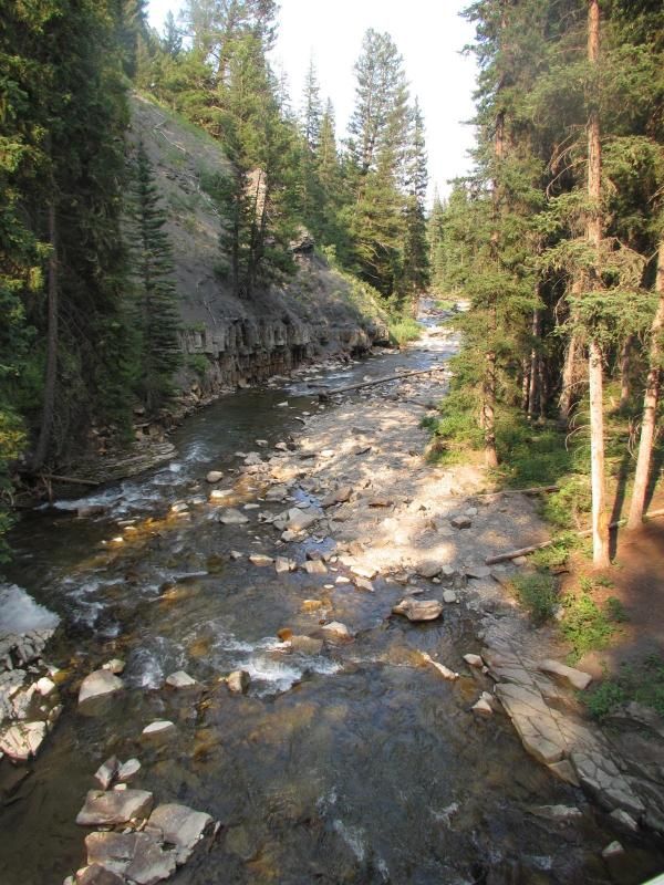
  • The first shot is from the bridge looking upstream.
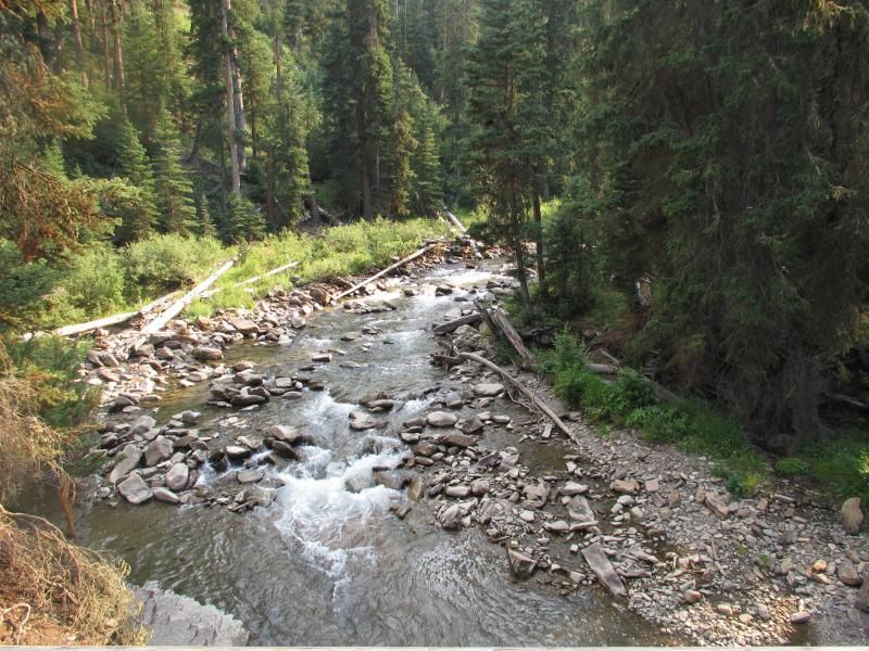
    The second shot is from the bridge looking downstream.


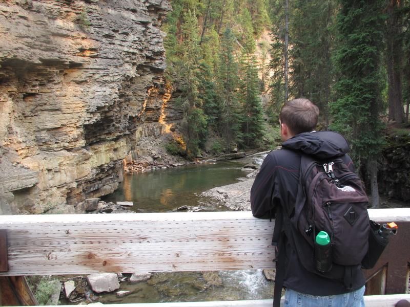
    .5 of a mile into the "hike" on another really nice bridge.


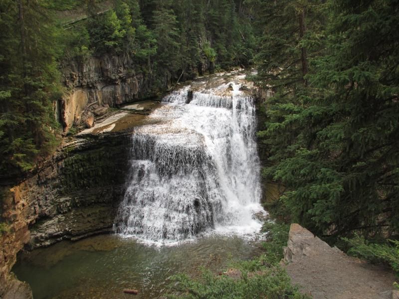
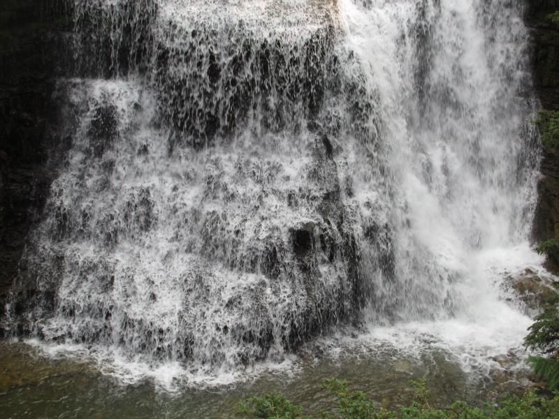
    .8 of a mile into the "hike" we reached Ousel Falls.

    From the highest vantage point.


    99 Dub Ya Jay

    My Adventures Thread
    http://sisoffroad.com/forums/showthread.php?t=15148

    Comment


    • At the top of the falls.


      At the bottom of the falls. From a few different angles.


      99 Dub Ya Jay

      My Adventures Thread
      http://sisoffroad.com/forums/showthread.php?t=15148

      Comment


      • The falls & me.


        Pretty close to the falls.


        99 Dub Ya Jay

        My Adventures Thread
        http://sisoffroad.com/forums/showthread.php?t=15148

        Comment


        • A couple shots from the hike heading away from the falls.


          1.25 miles into the "hike" on the way back. I spotted this area off trail on the way to the falls and wanted to get a few pictures there.


          99 Dub Ya Jay

          My Adventures Thread
          http://sisoffroad.com/forums/showthread.php?t=15148

          Comment


          • The 1.75 mile hike took 1 hour. Started at 530pm and finished at 630pm. The trail varied in elevation from 6,500 feet to 6,625 feet. A total elevation gain of only 125 feet. The "hike" didn't feel like a hike because the trail was more like a boardwalk than backcountry, but the falls are spectacular. As are most waterfalls.

            Between - Bacon Rind Creek & Ousel Falls we hiked 6.5 miles.

            We saw waterfalls, thunder, lightening, heavy rain & hail, but no wildlife.


            99 Dub Ya Jay

            My Adventures Thread
            http://sisoffroad.com/forums/showthread.php?t=15148

            Comment


            • I left from Canyon Village, WY & my girlfriend left from Big Sky, MT on August 5th with the goal of hiking Purple Mountain.

              The trailhead is 25 miles southwest of Canyon Village.
              The trailhead is 71 miles southeast of Big Sky.

              Left at 100pm.


              1.25 miles into the hike. This is the point at which we turned around 6 days prior due to a storm.


              99 Dub Ya Jay

              My Adventures Thread
              http://sisoffroad.com/forums/showthread.php?t=15148

              Comment


              • 2.5 miles into the hike looking south through the trees getting higher up. The faint road is a section between Madison Junction and Old Faithful.


                2.75 miles into the hike looking east through the trees getting higher up. The river is the Gibbon & the road is a section between Madison Junction and Norris Junction.


                3.25 miles into the hike at the actual summit of Purple Mountain. The summit elevation is 8,425 feet.


                99 Dub Ya Jay

                My Adventures Thread
                http://sisoffroad.com/forums/showthread.php?t=15148

                Comment


                • The view a hundred yards from the summit looking south towards Old Faithful.


                  Near the summit looking southwest towards Idaho.


                  99 Dub Ya Jay

                  My Adventures Thread
                  http://sisoffroad.com/forums/showthread.php?t=15148

                  Comment


                  • Taking in the view....


                    99 Dub Ya Jay

                    My Adventures Thread
                    http://sisoffroad.com/forums/showthread.php?t=15148

                    Comment


                    • Me & the view....


                      99 Dub Ya Jay

                      My Adventures Thread
                      http://sisoffroad.com/forums/showthread.php?t=15148

                      Comment


                      • 5.5 miles into the hike and 1 mile left. This is what the majority of the hike was like.... switchbacks.


                        The 6.5 mile hike took 3 hours. Started at 100pm and finished at 400pm. The trail varied in elevation from 6,875 feet to 8,425 feet. A net elevation gain of 1,550 feet.

                        1,550 feet for Purple Mountain is the 2nd most net elevation gain this season.
                        1,750 feet for Daly to Teepee is the most net elevation gain so far this season.

                        We reached the summit in 1 hour 45 minutes. Spent 15 minutes on top. Took 1 hour to get back to the trailhead.

                        Below is the trailhead picture from 6 days prior. A thunder & lightning storm turned us around 1.25 miles into the hike.


                        & in other news.... bear attack in the park today.

                        http://www.nps.gov/yell/parknews/13065.htm

                        99 Dub Ya Jay

                        My Adventures Thread
                        http://sisoffroad.com/forums/showthread.php?t=15148

                        Comment


                        • I left Big Sky, MT around 200pm on August 20th with the goal of hiking to the Cougar Creek patrol cabin.

                          The trail head is around 65 miles southeast of Big Sky.
                          The trail head is around 6,750 feet in elevation.

                          Left at 330pm.


                          .25 of a mile into the hike with the Madison River behind me.


                          Still around .25 of a mile into the hike. A chipmunk....


                          99 Dub Ya Jay

                          My Adventures Thread
                          http://sisoffroad.com/forums/showthread.php?t=15148

                          Comment


                          • .5 of a mile into the hike heading up away from the Madison River.


                            1 mile into the hike. A huge meadow in front of the Gallatin Range & some smoke from the wildfires.


                            1.25 miles into the hike entering the meadow with smoke still visible.

                            99 Dub Ya Jay

                            My Adventures Thread
                            http://sisoffroad.com/forums/showthread.php?t=15148

                            Comment


                            • 1.4 miles into the hike we reached the only trail marker of the day. We headed right towards Upper Cougar, which is where the patrol cabin is supposed to be. The problem is that we lost the trail a few hundred feet after the trail marker.

                              This is the first unmaintained trail I've hiked in Yellowstone & apparently when they say unmaintained they mean no trail. We would have needed GPS to find the Cougar Creek patrol cabin. After a .25 of a mile walking north through thick sagebrush we found a "trail" & continued on.


                              2.75 miles into the hike behind a really dry watering hole. We turned around a .25 of a mile later after the "trail" we found headed down an embankment and disappeared.


                              99 Dub Ya Jay

                              My Adventures Thread
                              http://sisoffroad.com/forums/showthread.php?t=15148

                              Comment


                              • 3.5 miles into the hike looking back at the Gallatin Range. The smoke plume disappeared in an hour when the wind died down.


                                4 miles into the hike. This meadow is normally full of bison, but during rut aka mating season they are in Lamar Valley & Hayden Valley.

                                We followed the "trail" all the way back instead of trekking through the thick sagebrush & came out further from the trail marker than I anticipated, but were still in good shape.


                                99 Dub Ya Jay

                                My Adventures Thread
                                http://sisoffroad.com/forums/showthread.php?t=15148

                                Comment

                                Working...
                                X